
Introduction
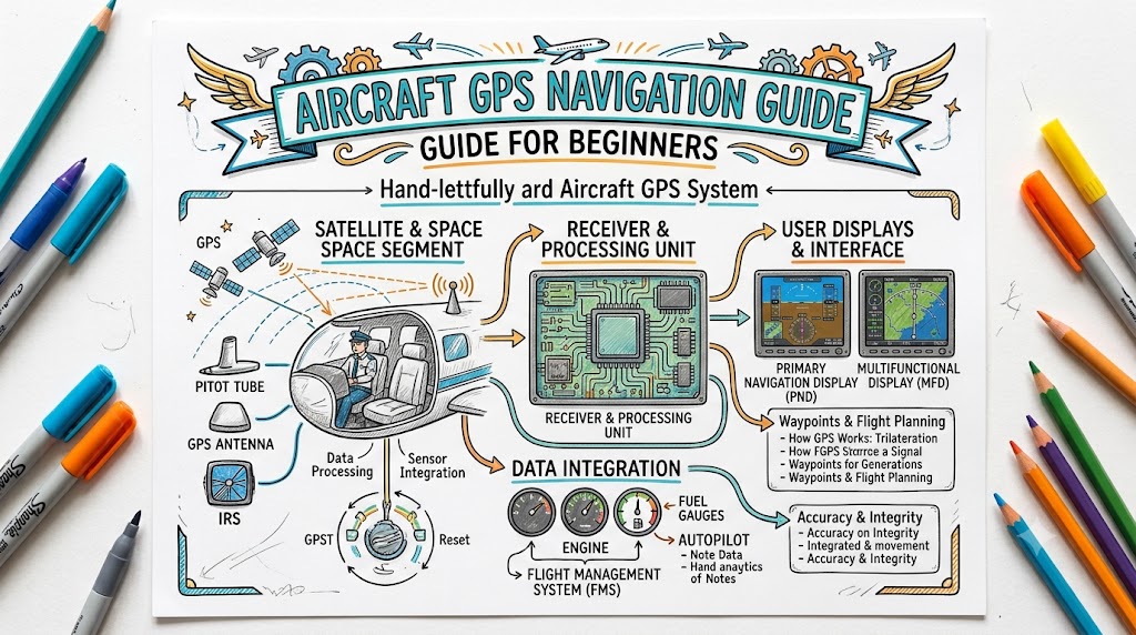
Aircraft GPS navigation has changed how pilots plan routes, monitor flight progress, locate airports, and maintain situational awareness. Instead of relying only on ground-based navigation aids, visual landmarks, headings, and estimated flight times, pilots can now see their position and route information directly on a cockpit display.
However, aircraft GPS is not simply a moving map that tells a pilot where to go. It is an aviation navigation system that must be programmed, checked, monitored, and understood correctly.
Beginners must learn what the information on the screen means, how waypoints are selected, how flight plans are entered, and what to do when the system gives an alert or stops working.
This Aircrafto guide explains aircraft GPS navigation in simple language while highlighting the habits that help pilots use it safely.
What Is Aircraft GPS Navigation?
Aircraft GPS navigation uses signals received from satellites to calculate the aircraft’s position. The navigation unit then combines that position with information stored in its aviation database.
Depending on the equipment, the GPS may display:
- Present aircraft position
- Planned flight route
- Bearing to the next waypoint
- Distance remaining
- Ground speed
- Estimated time of arrival
- Track over the ground
- Nearby airports
- Controlled airspace
- Navigation alerts
- Approach procedures
GPS navigation is commonly used during VFR and IFR operations, but the equipment and approval requirements are different for each type of flight.
The FAA advises VFR pilots to combine GPS information with pilotage, dead reckoning, current charts, and other available navigation methods instead of depending on a single display.
GPS and GNSS Explained Simply
The terms GPS and GNSS are sometimes used as though they mean the same thing.
GPS, or Global Positioning System, refers to the satellite navigation system operated by the United States.
GNSS, or Global Navigation Satellite System, is a broader term covering satellite-based navigation systems. Modern avionics may use signals from more than one satellite constellation, although pilots often continue to describe the equipment simply as GPS.
For a beginner pilot, the important point is that the receiver calculates the aircraft’s location from satellite signals and presents useful navigation information through a cockpit display.
Main Types of Aircraft GPS Equipment
Panel-Mounted GPS
A panel-mounted GPS is permanently installed in the aircraft. It may be connected to the aircraft’s:
- Course deviation indicator
- Horizontal situation indicator
- Primary flight display
- Multifunction display
- Autopilot
- Communication radio
- Flight management system
Some panel-mounted units are approved for VFR use only, while others are approved for IFR en-route, terminal, and approach operations.
Pilots must check the aircraft flight manual, equipment documentation, operating limitations, and installation approval to understand what a particular unit is legally permitted to do.
Portable Aviation GPS
Portable GPS receivers are commonly used for VFR navigation and situational awareness. They may display maps, terrain, airports, weather information, and airspace boundaries.
However, a portable receiver should not automatically be treated as approved IFR navigation equipment.
FAA guidance states that hand-held and VFR GPS systems are not authorized as the primary navigation reference for IFR operations or instrument approaches.
Tablets and Aviation Apps
Tablets running aviation applications can provide:
- Moving maps
- Digital charts
- Airport information
- Weather products
- Flight planning
- Traffic information
- Terrain warnings
- Checklists and documents
A tablet may function as an electronic flight bag, but its legal role depends on the operation, equipment, software, data, and applicable aviation regulations. The FAA’s active electronic flight bag guidance describes acceptable methods for using hosted databases and digital aviation information in Part 91 operations.
Flight Management Systems
Larger and more advanced aircraft may use a flight management system, commonly called an FMS.
An FMS combines navigation receivers, sensors, computers, and a navigation database. It may receive information from GPS, VOR, DME, inertial systems, and other sources to calculate the aircraft’s navigation solution.
Essential Aircraft GPS Terms for Beginners
Waypoint
A waypoint is a defined geographical position used to build a route. It may represent an airport, navigation aid, intersection, reporting point, or computer-generated navigation fix.
Pilots must verify waypoint identifiers carefully because similar identifiers can exist in different regions.
Active Leg
The active leg is the route segment the GPS is currently using. It normally runs from the previous waypoint to the next active waypoint.
Before following GPS guidance, confirm that the displayed active leg matches the intended route.
Bearing
Bearing is the direction from the aircraft’s present position to a selected waypoint.
Desired Track
Desired track is the intended ground path between two route points.
Actual Track
Actual track is the path the aircraft is currently following across the ground.
Wind may cause the aircraft’s heading and track to be different.
Ground Speed
Ground speed is the aircraft’s speed relative to the earth’s surface. It may be higher or lower than true airspeed depending on the wind.
Distance to Waypoint
This shows the remaining distance from the aircraft to the active waypoint.
Estimated Time En Route
Estimated time en route indicates approximately how long it will take to reach the waypoint or destination at the present ground speed.
Course Deviation Indicator
The course deviation indicator, or CDI, shows whether the aircraft is left or right of the selected course.
Pilots must know whether the CDI is receiving information from GPS, VOR, localizer, or another navigation source.
Direct-To Function
The Direct-To function creates immediate navigation guidance from the aircraft’s present position to a selected waypoint.
It is convenient, but frequent use without route awareness can create airspace, terrain, fuel, or traffic-management problems.
Nearest Airport Function
The nearest airport function displays airports close to the aircraft.
This can be valuable during diversions and emergencies, but the nearest airport is not always the most suitable airport. Runway length, weather, terrain, fuel, lighting, services, and aircraft performance must also be considered.
How to Use Aircraft GPS Navigation Step by Step
Learn the Unit Before Flying
Aircraft GPS units differ in their menus, knobs, touchscreen controls, alert messages, and operating logic.
Study the pilot guide and practise using an approved simulator or ground-training mode. The FAA specifically recommends gaining thorough operational knowledge because GPS receivers can operate differently, even between models from the same manufacturer.
Avoid learning complex functions for the first time while flying.
Check the Navigation Database
Before flight, check:
- Database issue date
- Database expiry date
- Geographic coverage
- Airport information
- Waypoint availability
- Procedure availability
- Published database limitations
For IFR operations, the onboard navigation data must be current and appropriate for the intended region. Instrument procedures must be retrieved from the current airborne navigation database rather than built manually from coordinates.
An outdated database can show removed waypoints, changed airspace, modified frequencies, or outdated procedures.
Review NOTAMs and GPS Availability
Pilots should check applicable NOTAMs before relying on GPS, particularly when planning IFR operations.
GPS testing, signal interference, WAAS limitations, procedure restrictions, and navigation facility outages may be published through NOTAMs. FAA guidance requires pilots to review appropriate NOTAMs and aeronautical information before GPS IFR operations.
Build the Flight Plan
Enter the route in the correct order:
- Departure airport
- Departure procedure, when applicable
- En-route waypoints
- Airways or route segments
- Arrival procedure, when applicable
- Destination airport
- Instrument approach, when applicable
Do not assume the route is correct simply because the GPS accepted it.
Verify Every Route Point
Compare the GPS flight plan with current aviation charts and the approved route.
Check:
- Airport identifiers
- Waypoint spelling
- Route order
- Airways
- Altitudes
- Restricted or controlled airspace
- Departure and arrival transitions
- Approach name
- Runway
- Final approach fix
- Missed approach instructions
FAA guidance advises pilots to verify that waypoint and transition names in the GPS match those printed on the applicable procedure chart.
Confirm the Navigation Source
Before departure, confirm whether the aircraft’s course indicator is using GPS or another navigation source.
A correctly programmed GPS is not useful when the CDI is still connected to a VOR or localizer source.
Many glass-cockpit aircraft show the active navigation source through labels or colour coding. Pilots must understand the indication used in their particular aircraft.
Select a Useful Map Range
A very close map range may show excellent local detail but hide the larger route picture.
A very wide map range may show the entire route but hide nearby airspace, terrain, traffic, and waypoints.
Adjust the range based on the phase of flight:
- Wider range during route review
- Medium range during cruise
- Closer range during terminal operations
- Appropriate range for weather and traffic awareness
Monitor Waypoint Sequencing
Most GPS units automatically sequence from one waypoint to the next.
As the aircraft passes a waypoint, confirm that:
- The correct next waypoint becomes active
- The route direction is correct
- The desired track makes sense
- The aircraft is not being guided toward an unexpected leg
Automatic sequencing should always be monitored.
Cross-Check the GPS
Compare GPS information with:
- Outside visual references
- Aircraft heading
- Magnetic compass
- VOR or DME information
- Current charts
- Estimated times
- Fuel consumption
- Air traffic control clearances
The FAA recommends systematic cross-checking because a GPS position may be unreliable when satellite reception, equipment, antenna placement, or signal integrity is affected.
Understanding WAAS
WAAS stands for Wide Area Augmentation System.
It improves GPS accuracy and provides integrity information for aviation users. Properly equipped aircraft can use WAAS during en-route navigation, departures, arrivals, and qualified approaches with vertical guidance.
A WAAS-capable receiver may support approach minimums such as:
- LNAV
- LP
- LNAV/VNAV
- LPV
The minimums available depend on the aircraft equipment, receiver approval, procedure design, signal availability, and current operational conditions.
Pilots should never assume that every GPS unit is WAAS capable or that every GPS approach provides vertical guidance.
Understanding RAIM
RAIM means Receiver Autonomous Integrity Monitoring.
RAIM allows a GPS receiver to monitor the integrity of the satellite information it is using. It can alert the pilot when sufficient integrity is unavailable or when inconsistent navigation information is detected.
RAIM is particularly important for certain non-WAAS IFR GPS operations.
When a RAIM failure or integrity alert occurs, pilots must follow the equipment guidance and applicable procedures. During an instrument approach, the GPS information may become advisory only, and the approach may need to be discontinued.
VFR and IFR GPS Use
GPS Use During VFR Flight
During VFR flight, GPS can improve situational awareness and help pilots:
- Follow a planned route
- Identify nearby airports
- Monitor airspace boundaries
- Calculate distance and time
- Locate checkpoints
- Support diversion planning
- Maintain awareness in unfamiliar areas
However, VFR pilots should continue using outside references, current charts, pilotage, and dead reckoning.
A moving map does not remove the pilot’s responsibility to maintain visual awareness, avoid airspace violations, monitor weather, and see other aircraft.
GPS Use During IFR Flight
IFR GPS use requires properly approved equipment and installation.
The pilot must understand:
- Equipment authorization
- Navigation database requirements
- RAIM or WAAS capability
- CDI sensitivity
- Procedure loading
- Approach activation
- Missed approach operation
- GPS failure procedures
- Required alternative navigation equipment
Portable and VFR-only GPS systems may support situational awareness during IFR flight, but they cannot replace approved IFR navigation equipment.
Loading and Activating an Instrument Approach
Loading and activating are not always the same action.
Loading an approach places the procedure into the flight plan.
Activating an approach makes a particular approach leg active and may change how the unit sequences waypoints.
Beginners should be especially careful when:
- Receiving vectors to final
- Changing runways
- Selecting a different transition
- Flying a procedure turn
- Activating a leg
- Using Direct-To near an approach
- Beginning a missed approach
Selecting the wrong approach leg can remove required route segments or create unexpected guidance.
Approach procedures should be retrieved by name from the current navigation database. Manually creating an approach from coordinates or user waypoints is not permitted for approved IFR approach operations.
Common Aircraft GPS Navigation Mistakes
Entering the Wrong Waypoint
A single incorrect letter can select a waypoint in the wrong location.
Always verify the waypoint name, region, bearing, and distance.
Following the Magenta Line Without Thinking
The displayed route does not guarantee protection from:
- Terrain
- Restricted airspace
- Bad weather
- Traffic
- Fuel shortages
- Aircraft performance limitations
The pilot remains responsible for evaluating the complete flight situation.
Spending Too Much Time Looking Inside
Excessive button pressing can reduce outside awareness and increase the risk of losing aircraft control.
Complete complicated programming on the ground whenever possible.
Using Direct-To for Every Change
Direct-To may create a route that crosses unsuitable terrain, controlled airspace, weather, or restricted areas.
Review the new route before accepting it.
Confusing Heading With Track
Heading is where the aircraft nose is pointing. Track is the path the aircraft is following over the ground.
Wind can create a significant difference between them.
Ignoring the Active Navigation Source
A pilot may follow a GPS flight plan while the flight display remains connected to a VOR or localizer source.
Confirm the active source before following CDI guidance.
Using an Outdated Database Near Complex Airspace
FAA guidance recommends keeping databases updated for all operations and warns against relying on an outdated moving map around critical airspace.
Failing to Verify Automatic Sequencing
The GPS may activate a leg the pilot did not expect, particularly after route changes, procedure activation, or manual leg selection.
Depending on One Device
Portable devices can overheat, lose power, lose signal reception, close unexpectedly, or suffer software problems.
Carry appropriate backups and know how to navigate without the device.
What to Do During a GPS Failure
The first priority is always to fly the aircraft.
A practical response may include:
- Maintain aircraft control.
- Confirm the correct navigation source.
- Check circuit breakers only when permitted and appropriate.
- Review warning messages and annunciations.
- Compare the GPS position with other instruments and visual references.
- Change to another approved navigation source.
- Inform air traffic control when operating under IFR.
- Request vectors, a revised clearance, or another approach when necessary.
- Use current charts and backup navigation methods.
- Land at a suitable airport if safe navigation cannot be assured.
The FAA maintains conventional navigation capability through the VOR Minimum Operational Network in parts of the United States to support navigation during GNSS disruptions. It also recommends maintaining proficiency with alternative navigation methods and considering possible GPS outages during flight planning.
GPS Jamming and Spoofing Awareness
GPS signals can be affected by interference.
Jamming prevents or reduces reliable satellite reception.
Spoofing causes a receiver to calculate an incorrect position by presenting false or misleading signal information.
Possible warning signs include:
- Sudden position movement
- Impossible ground speed
- Route disagreement between devices
- Incorrect time information
- Unexpected terrain or airspace alerts
- Navigation disagreement with visual references
- Aircraft position disagreement reported by ATC
A receiver may not always detect misleading signals. FAA guidance recommends transitioning to another navigation source and requesting an amended ATC clearance when a navigation error is suspected.
Beginner GPS Preflight Checklist
Before relying on aircraft GPS, verify:
- The correct aircraft and equipment profile is selected.
- The navigation database is suitable and current.
- The route matches current charts.
- Waypoint identifiers are correct.
- Required procedures are available.
- Applicable NOTAMs have been reviewed.
- The device has sufficient power.
- Backup power is available for portable equipment.
- The mount and antenna position are secure.
- The correct navigation source is selected.
- The pilot knows how to cancel Direct-To guidance.
- The pilot understands waypoint sequencing.
- Alternative navigation methods are available.
- The GPS failure procedure is understood.
Best Practices for Safe GPS Navigation
- Learn the exact GPS model installed in the aircraft.
- Use simulator training before operating the unit in flight.
- Programme the route before engine start when practical.
- Compare every flight plan with current charts.
- Verify every procedure, transition, and runway.
- Keep the navigation database current.
- Review GPS and WAAS NOTAMs.
- Maintain an outside visual scan during VFR flight.
- Use appropriate cockpit task management.
- Cross-check heading, track, distance, time, and fuel.
- Maintain proficiency with pilotage, dead reckoning, and conventional navigation.
- Never allow GPS programming to become more important than flying the aircraft.
Frequently Asked Questions
Is aircraft GPS difficult for beginners?
The basic functions are not difficult, but each receiver has different controls and operating logic. Beginners should practise route entry, Direct-To navigation, procedure loading, source selection, and failure recovery on the ground.
Can a pilot fly using only a tablet GPS?
A tablet may provide excellent situational awareness, but its legal role depends on the flight operation and equipment. A portable tablet is not automatically approved as the primary navigation system for IFR flight.
What is the difference between bearing and track?
Bearing is the direction from the aircraft to a selected point. Track is the aircraft’s actual path over the ground.
Does aircraft GPS show altitude?
Many GPS units display GPS-derived altitude, but pilots should not treat it as a replacement for the aircraft’s approved pressure altimeter. The two values are calculated differently.
What does Direct-To mean?
Direct-To creates a route from the aircraft’s current position to a selected waypoint. The pilot should review terrain, airspace, weather, fuel, and operational suitability before following it.
Can GPS work without internet service?
Installed aviation GPS receivers obtain position information from satellites and do not require internet access for basic navigation. Internet or data connections may still be needed for downloading charts, databases, weather, or other services.
What happens when the GPS database expires?
The receiver may continue displaying position information, but the use of outdated database information can be restricted. Current databases are required for many IFR operations, especially instrument procedures.
What is the difference between loading and activating an approach?
Loading places the approach in the flight plan. Activating makes a selected approach leg active. Activating the wrong leg can cause unexpected waypoint sequencing.
Is WAAS required for every GPS approach?
No. Some GPS approaches can be flown with approved non-WAAS equipment, while other minimums and vertical-guidance capabilities require suitable WAAS equipment.
Should pilots still learn VOR and traditional navigation?
Yes. GPS can fail or become unreliable. Knowledge of charts, pilotage, dead reckoning, VOR navigation, and communication with air traffic control provides essential backup capability.
Conclusion
Aircraft GPS provides accurate route guidance and valuable situational awareness, but safe use requires more than following a moving map. Beginner pilots should understand their equipment, verify every route, keep databases current, cross-check GPS information, maintain an outside scan, and remain prepared to navigate without satellite guidance.

